
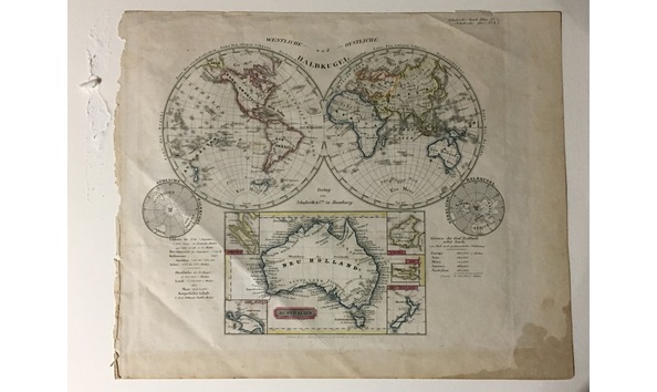
German World Map Circa 1850-1860
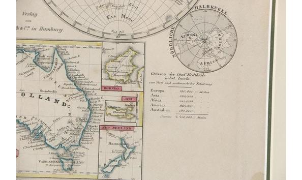
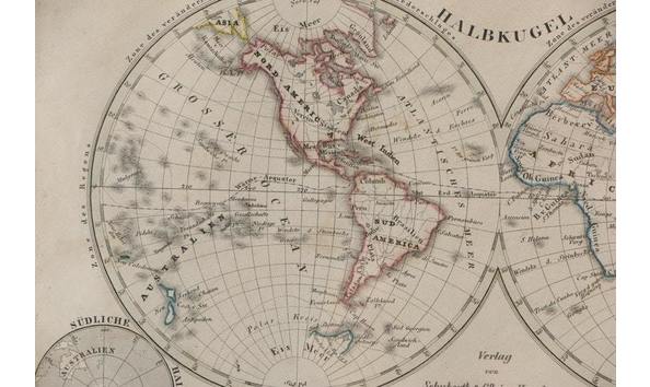
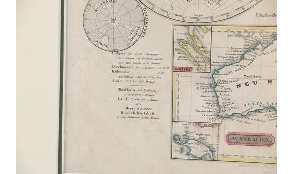
Map. "Oestliche und Westliche Halbkugel". The Two Hemispheres, with inset views of the Poles, and a large inset map of New Holland / Australia. Being Plate 5 from Schuberth's Hand-Atlas.
Circa 1850-1860
Founded in 1826 by Julius Ferdinand Georg Schuberth (1804-1875) in Hamburg. Branch offices were opened in Leipzig (1832) and New York (1850). In the 1830s the imprint Schuberth & Niemeyer was used, until G.W. Niemeyer left to set up his own business in 1839. Julius left the Hamburg office in charge of his brother Friedrich (Fritz) - Friedrich Wilhelm August Schuberth (1818-1890) in 1854, devoting his energies to the activities of the Leipzig and New York branches." It appears that much of their business involved sheet music rather than maps. Their maps are uncommon. This is one map which was extracted from an atlas that may have had 60 maps. This would likely be of significant interest to Australians.